Have you ever wanted to provide the community with access to your flooding data online but didn't know how?
In this first installment of a 3 part series we investigate the What? Why? and How? of building a community flood portal using our new waterRIDE LITE module, making simple, understandable and usable flood information available to the community, on any device.
waterRIDE LITE is a web-app designed to provide simple, clear access to flooding information via a browser (ie no installation).
What sets it apart is the simplicity of its interface, the ease with which it can be setup, and its ability to link directly to your flood datasets, live.
Designed to integrate seamlessly with a waterRIDE CLOUD (hosted) installtion, you need only select a view from any waterRIDE project and publish it to the web using the interface (ie you'll end up with a link something like www.waterRIDE.net/FloodData/YourOrganisation).
waterRIDE LITE will then replicate that view, including thematic settings, on the users device using familiar mapping frameworks such as Google, BING, Apple Maps and OpenStreetMaps, amongst others.
By adding multiple views you can provide structured access to various layers such as 1 in 100yr and PMF design floods, historical events, and even current or forecast conditions.
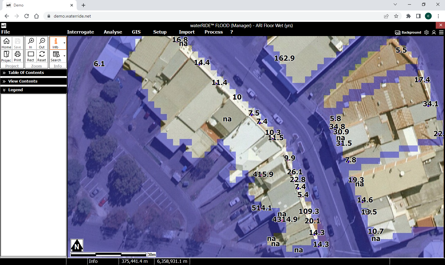
You can make the mapping truly interactive by configuring live access to your flood surface data. Providing more than just a map, this enables your users to click on any location to interrogate the underlying hydraulic parameters at that location(s) (eg depth and level, or depth and velocity, or perhaps depth only - you choose from any hydraulic parameter(s)).
Adding this interrogatability helps overcome the limitations of basic web mapping where simple maps only allow users to determine if "they are wet or not", rather than by how much.
To further help the community comprehend the impacts of flooding, you can establish live links to Google StreetView with your flood levels superimposed (as shown below).
Finally, if you have an automated flood certificates system setup, you can allow the community to easily search for and request their flood certificate, all generated live from the same waterRIDE CLOUD configuration that you use, including the option for a credit card payment gateway (coming soon).
Live linking to your central datasets means that if you make changes to your flood datasets, or certificates system configuration, or view settings, these changes are immediately reflected in the waterRIDE LITE interface.
If you wanted to have a look at our demo to get a feel for waterRIDE LITE, head to: https://waterride.net/wrlite/
In the next installment, we will look at some reasons why you may want to consider making flood information available to the community, including the results of community interviews and social media investigations we have carried out to help define the communities expectations.
We thoroughly enjoyed catching up with everyone at the FMA conference in Toowoomba last year and are excited to do so again in Sydney next week.
We have a waterRIDE trade booth at the conference so please feel free to drop by for a chat or demo, or to ask any curly questions.
Zhifang and Cameron are also presenting papers on some of the interesting work we have been doing.
Cameron's paper, Empowering The Community – Access to Usable Flooding Information, is on Wednesday 24th at 11:45am.
Zhifang's paper, Real-time multicatchment flood forecasting along a remote rail network, is on Friday 26th at 2:15pm.
We look forward to catching up with you!
Those customers who have already moved to waterRIDE CLOUD are throughly enjoying their experience, accessing waterRIDE via their web browser from anywhere.
If you've been thinking about cloud (and you should be), we have an end of financial year offer that launches next week.
For a sneak peak of the offer, head to this link.
With our web-based license server being operational for the past 2 years with zero downtime, the "on-prem" waterRIDE License Server application has now officially reached its end of life.
The web-based license server provides a more convenient and reliable means for waterRIDE Classic users to use their waterRIDE license(s) anywhere there is internet access, and removes the need for local IT to support an additional server application.
You can continue to use your "on-prem" license server (assuming maintenance is fully paid), but we will not be issuing any updates to the server software.
To transition, just contact us and we'll move your organisation across to the web server (no additional fee).
Our next group training sessions will be held from 20th to 29th June, 2023.
The sessions are half-day (9am to 12pm/1pm AEST), fully interactive and delivered remotely using waterRIDE CLOUD:
• Viewer - 20th
• Essentials - 21st
• Flood Intelligence - 22nd
• Working with Model Data - 27th
• waterRIDE in the Enterprise - 28th
• Automated Flood Certificates - 29th
To find out more including session content, pricing and to book your spot, please head to the training section of our website.