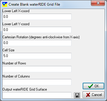
This is a general tool for creating blank waterRIDE™ grids. Often these grids are then used as a framework onto with terrain and water surfaces are mapped.
There are two methods for creating blank grids:
User Defined
Optimised For a Polygon
Will create the smallest, rotated grid that contains the first polygon in the specified GIS layer.