The Intelligence toolsets facilitate in-depth analysis of your flood surfaces to derive new datasets (intelligence) to enhance understanding of the consequences of flooding.
Analysis can be an integration of the flood surfaces with GIS datasets (such as assets, properties, roads etc), or an an analysis of the flood surfaces themselves.
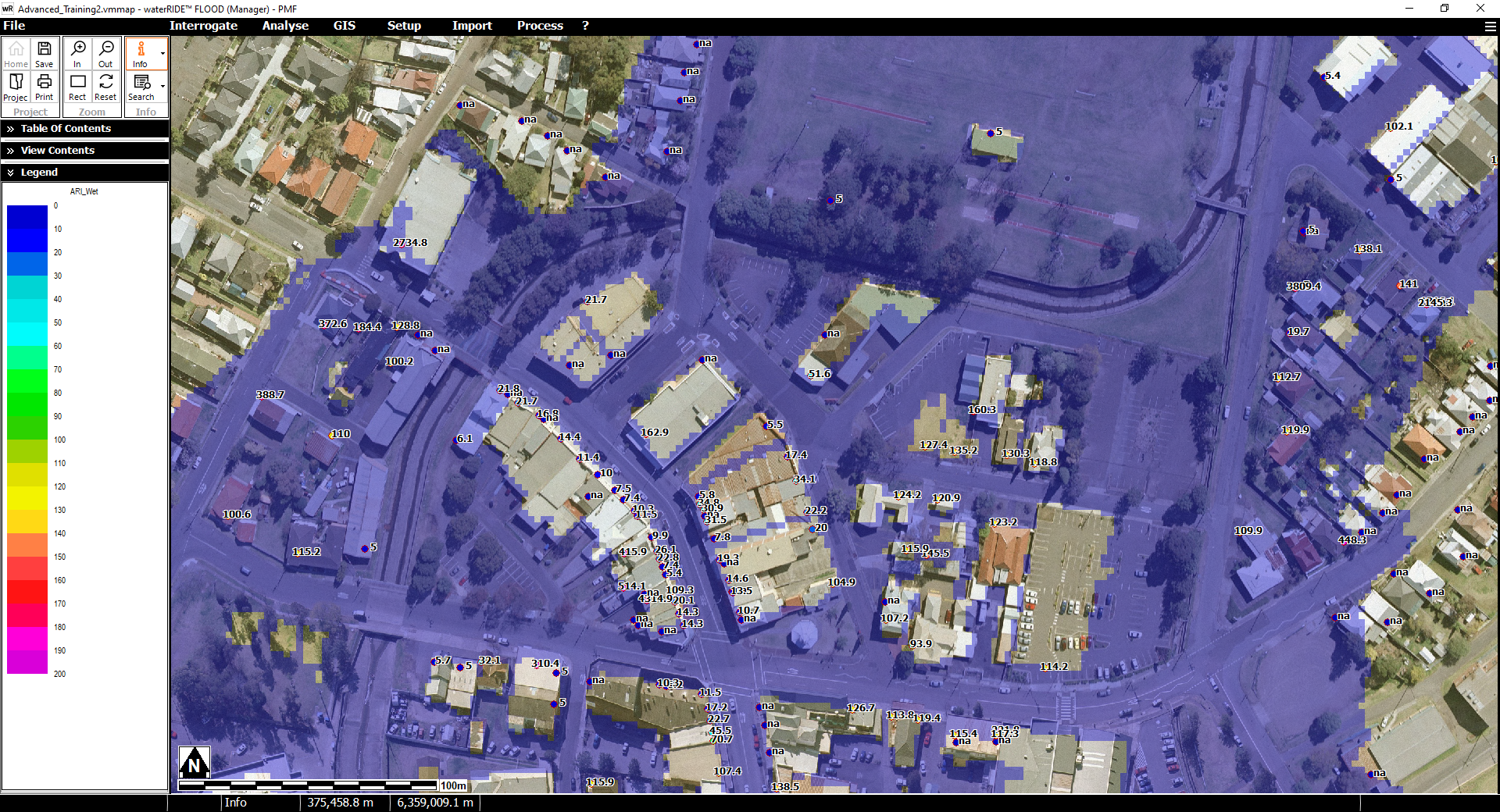
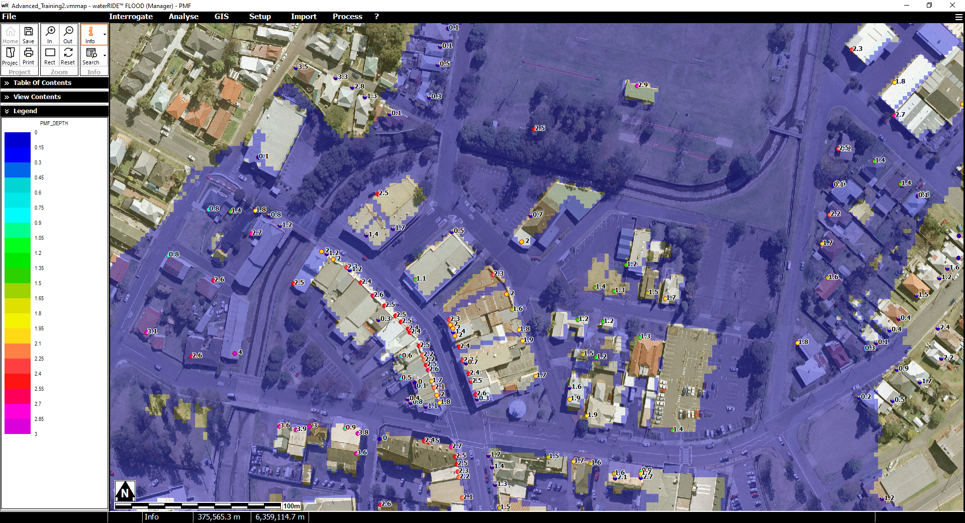
Example items of intelligence are shown below:
Depth Over Floor (flood surface integrated with a GIS layer of floor levels)
ARI Of Inundation (flood surface across a range of probabilities are used to determine the ARI that the floor level field is inundated at)