The DEM builder tool is used to build a single, seamless DEM from any number of terrain sources. Some of its common uses include:
•building a single DEM from tiled LiDAR data (or a tiled DEMs)
•merging DEMs using different source data (eg LiDAR where available, then SRTM, then course satellite data)
•Creating a small DEM in an area of interest from a large DEM
•Updating an existing DEM with new terrain data (or filling the "gaps" in an existing DEM) such as burning a bathymetric DEM into a LiDAR DEM
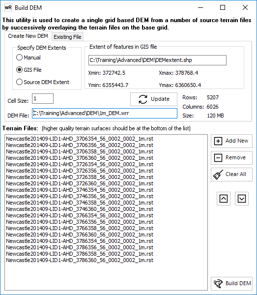
Build New
1. Specify the DEM extents as either:
•Manual - enter Min/Max X/Y coords
•GIS file - uses the extent of the first object (often a polygon drawn in waterRIDE) in a GIS layer
•Source DEM Extent - uses the extents (bounding rectangle) of the source DEM datasets
2. Specify the desired cell size
3. Click the "update" button to verify the size of the DEM. Very large DEM's (> 500MB "size") will benefit from building pyramids.
4. Specify the output file
5. Add the source DEM's to the list (rst, wrr, or wrb files). The order of the list is the same as waterRIDE's draw order (ie the layer at the top of the list is draped first, and will be overwritten by any subsequent layers that overlap). This means that the lower quality terrain datasets should be at the top of the list, and the higher quality at the end.
Update Existing
This tool operates in the same was the "build new" except that an existing DEM can be updated. Use the tick boxes to decide whether the existing terrain should be cleared first and/or whether all values in the DEM should be updated , or only those that are currently blank (delete value).