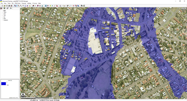
What is waterRIDE™ 10?
waterRIDE™ 10 represents a strong design shift from v8 with a focus on a modern, lean, fast, clear and spacious interface.
Intuitive workflow-based access to the existing rich array of floodplain management tools merges with a host of new processing and data management tools.
The modern, yet instantly familiar interface embraces simplicity and speed, for both new and experienced users alike.
waterRIDE™ 10 is designed to let you do more, faster, even with tools that have been in waterRIDE™ for years!
Why have some tools been moved?
Hopefully this becomes self-evident as you start using waterRIDE™ 10, but in v8.99.xx many of waterRIDE™’s tools were “buried” in deep nested-menu structures. This meant that tools were both difficult and slow to locate.
With the introduction of “live panels”, the entire interface becomes clearer and quicker to use, as well as giving you more screen real estate.
Tools have been logically grouped according to workflow. In some cases, tools are duplicated across panels (for example, you may wish to drape model results onto LiDAR when importing but may also wish to drape results as part of an overlapping catchment merging process).
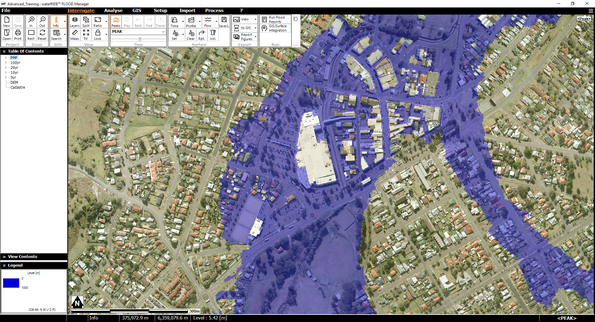
What is the logic behind the new “live panels” grouping?
Common Tools – Contains toolsets that are required irrespective of the content of the view. These reside above the Navbar.
Interrogate – Contains general toolsets for interrogation, export and project execution (flood forecasting, certificate creation, reporting etc).
Analyse – Contains toolsets for specific analysis of existing waterRIDE™ datasets including flood intelligence, damages, general calcs, planning, multi-surface and modeller based tools
GIS – Encompasses waterRIDE™’s tools for working with GIS layers themselves, including editing, creating, converting and setting up.
Setup – Contains toolsets for waterRIDE™-specific setup routines (views, certificates, reports, composite layers and flood forecasting)
Import – Contains tools to help you bring external datasets into waterRIDE™ and to make import-specific adjustments to these datasets.
Process – Contains tools that allow you to work with existing layers, including enhancing performance, merging, cleaning, extracting and batch processing.
Data Manager - Contains tools for mananging your flooding data.
I don’t know where the #### tool is? How can I find it?
We have prepared a table in this document as a direct 1:1 correlation between the “old” tool locations and the “new” location.
We have also developed a “Tool Search” button, which resides on the new FASTBAR (left click on the far right part of the map window).
What is the FASTBAR?
The FASTBAR can be accessed by clicking on the far right of the map window (it will glow orange).
The FASTBAR hosts a range of tools for rapidly interrogating multiple surfaces and toggling common view attributes, as well as searching for tools using keywords, tool names, and even v8.99.xx tool names.
What are some of the new time-saving user-shortcuts and tools?
•Auto Zoom-Lock – it’s smart enough to work out what you want to do. Set and forget!
•Maximise screen space by clicking in the active menu to hide it (floating mode) and/or resizing the Navbar.
•Use the FASTBAR to interrogate and plot from multiple surfaces at once
•Double click on a View in the tree to expand the view contents panel on the NavBar (if collapsed)
•Exporting figures – setup a Word template to receive your image exports, complete with title block and labelling
•Split View – Use split view to see side-by-side comparisons of two views (zoom/pan enabled)
•Drag and Drop layers directly into the map window
•Right click on a layer to access its info/metadata
•Drag and drop nodes/branches in the view tree
•Help -> About to check your version against the latest release
•See the timestep status: Map window, Interrogation-Time live panel, status bar
waterRIDE™ v8.99.xx
waterRIDE™ 10
MENUS
v8.99 Menu Sub-Menu Tool Name |
waterRIDE™ 10 Live Panel – Group Tool Name |
|||
|---|---|---|---|---|
File |
New, Open, Save |
File, Project toolset |
New, Open, Save |
|
Recent |
File |
Recent & Central |
||
Configuration |
File |
Configuration |
||
Relative/Full Path |
File |
Relative/Full Path |
||
Re-locate Files |
File |
Re-locate Files |
||
Pack-n-Go |
File |
Pack-n-Go |
||
Create project from template |
File |
Create project from template |
||
View |
Fit all layers |
Interrogate - View |
Fit |
|
Copy view setup |
Setup - View |
Copy View Setup |
||
Add/remove layers from multiple view |
Setup - View |
Multi-Layer Add/Delete |
||
Adjust window ratio |
Interrogate - View |
Ratio |
||
List All Layers |
Setup - View |
Content Lists |
||
Tools |
Search |
Info toolset |
Search |
|
Export |
Interrogate - Export |
View, GIS |
||
Plot |
Interrogate - Export |
Plot |
||
Composite Files |
Setup |
Composite Layers |
||
Record AVI |
Interrogate – Export |
Record AVI |
||
Compare View |
Interrogate - View |
Split View |
||
Manning Calcs |
Analyse - Calculate |
Mannings |
||
Repeat Last |
Interrogate - Surface |
Repeat last |
||
GIS |
GIS Toolbar |
GIS |
Drawing/Editing Toolset |
|
GIS Layer Tools |
GIS |
Tools toolset |
||
GIS Geometry Tools |
GIS |
Tools toolset |
||
GIS Export Tools |
GIS |
Export toolset |
||
Create New |
GIS |
Setup toolset |
||
Configure Database Layers |
GIS |
Setup toolset |
||
Configure Online Address Server |
GIS |
Setup toolset |
||
FPM Tools
FPM Tools |
Flood Surface Analysis |
Flood Planning Level Surface |
Analyse |
Planning toolset |
Time based queries |
Analyse |
Intelligence toolset – Queries |
||
Parameter queries |
Analyse |
Intelligence toolset – Queries |
||
Peak Flow Path Surface |
Analyse |
Calculate |
||
Statistical Analysis |
Analyse |
Multiple Surfaces |
||
Rate of Rise Analysis |
Analyse |
Intelligence |
||
GIS Processing |
Flood Extents & WL Contours |
Analyse |
Planning |
|
GIS/Surface Integration |
Analyse |
Intelligence – GIS Intelligence |
||
Identify Location and Min/Max Surface Values |
Analyse |
Intelligence |
||
Link to Gauge Level |
Analyse |
Intelligence |
||
Determine probability of Inundation |
Analyse |
Intelligence – Vulnerability |
||
Certificates & Reporting |
Setup Certificate |
Setup |
Certificates |
|
Setup Report |
Setup |
Reporting |
||
Flood Metadata |
Setup |
Certificates |
||
Setup House Photos |
Setup |
Certificates |
||
Property Tagging |
General |
Analyse |
Planning |
|
Environment Agency (UK) Approach |
Analyse |
Planning |
||
Flood Damages/Costs |
Property Flood Damages |
Analyse |
Flood Damages |
|
Inundation Time Damages |
Analyse |
Flood Damages |
||
Average Annual Calculations |
Analyse |
Flood Damages |
||
Surface Interpolation |
Interpolate Surface |
Import |
Create - Interpolate |
|
Sea Level Rise Adjustment |
Import |
Create - Interpolate |
||
Forecast |
Setup |
Setup |
Flood Forecasting |
|
Gauge Layers |
Setup |
Flood Forecasting |
||
Forecast Rainfall |
Setup |
Flood Forecasting |
||
Forecast Stormtide |
Setup |
Flood Forecasting |
||
Utilities
Utilities |
Convert |
Convert 2D Model to waterRIDE |
Import |
Convert – 2D Model |
Convert Hydrology Model |
Import |
Convert – Hydrology |
||
Convert wR Surface Network |
Process |
Performance |
||
Build Surface Pyramids |
Process |
Performance |
||
Transfer Water Surface to DTM |
Map/Overlay |
Process OR Import |
Merge-Drape and Merge OR Refine- Drape and merge |
|
Map on Fly |
Setup |
Composite |
||
1D-2D Filenames |
Import |
File utilities – Rename |
||
Differences |
wR Differences |
Analyse |
Multiple Surfaces |
|
wR Peaks |
Extract Peaks |
Process |
Extract |
|
Recalc Peaks |
Process |
Misc - Refresh |
||
Peak of Peaks |
Process |
Merge |
||
Update CFG |
Process |
Misc - Refresh |
||
Extract Peak Flows |
Process |
Extract |
||
Export Peak Surface |
Process |
Extract |
||
Stretch |
Various |
Import OR Process |
Refine OR Merge |
|
Clip |
Various |
Import OR Process |
Refine – Clip Layers
Clean – Clip Layers |
|
wR Flood Hazards |
Hazards Manager |
Import |
Change/Edit/Repair |
|
Change wR File Hazards |
Import |
Change/Edit/Repair |
||
Clean |
Clean Model Results (Direct Rainfall) |
Import OR Process |
Change/Edit/Repair OR Clean |
|
wR File Updates |
Time |
Import |
Change/Edit/Repair - Time |
|
Update/Adjust Terrain |
Import |
Terrain |
||
Adjust Water Levels |
Import |
Change/Edit/Repair – Adjust Values |
||
Coordinates |
Import |
Change/Edit/Repair – Coords and Datums |
||
Update CFG Min/Max |
Process |
Refresh |
||
Vertical Datum |
Import |
Change/Edit/Repair – Coords and Datums |
||
File info |
wR File Info |
Process |
Misc – wR File info OR Right click on layer |
|
Grids |
Grid Conversions |
Import |
Convert |
|
Grid Creation |
Import |
Create – New Grid |
||
Combine |
Combine Grid Surfaces |
Process |
Merge – Combine WRB |
|
Import DTM |
Import DTM (TIN) |
Import |
Terrain – Import |
|
Export Outline |
Export Network Outline |
Process |
Extract - Outlines |
|
Water Surface Bounding Polygon |
Process |
Extract - Outlines |
||
Extrapolate |
Extrapolate |
Import |
Create |
|
Binary Files |
Common Binary Files |
Import |
File Utilities |
|
Aerial Photos |
Aerial Photography Tools – Overviews |
Process |
Performance - Pyramids |
|
Help |
About |
? |
About |
|
PDF Help |
? |
PDF Help |
||
Tutorial |
- |
Moving to online |
||
Shortcuts |
? |
- |
||
TOOL
v8.99 Toolbar Tool Name |
waterRIDE™ 10 Live Panel – Group Tool Name |
||
|---|---|---|---|
Files |
Project toolset |
||
New, Open, Save |
File menu, Project toolset |
New, Open, Save |
|
Zoom |
Zoom Tools |
Zoom toolset |
Zoom In, Out, Window |
Pan Tool |
- |
Left click and hold |
|
Zoom Lock |
Zoom toolset |
Lock |
|
Reset view |
Zoom toolset |
Reset |
|
Object Info |
Info toolset |
Info |
|
Miscellaneous |
Toggle Layers |
Interrogate - View |
Layers |
Measure Distance |
Interrogate - View |
Measure |
|
Measure Volume |
Interrogate - Surface |
Volume |
|
Time |
Peaks, Animate, Step forward/back, tracer, timestep |
Interrogate |
Time toolset |
Water |
Time series plot, profile plot, flow plot, keypoints, saving points |
Interrogate |
Surface, Gauge, or Pipe Toolset (dependent on active layer type) |
Run |
Certificates, Forecast, GIS Integration, Report |
Interrogate |
Run toolset |