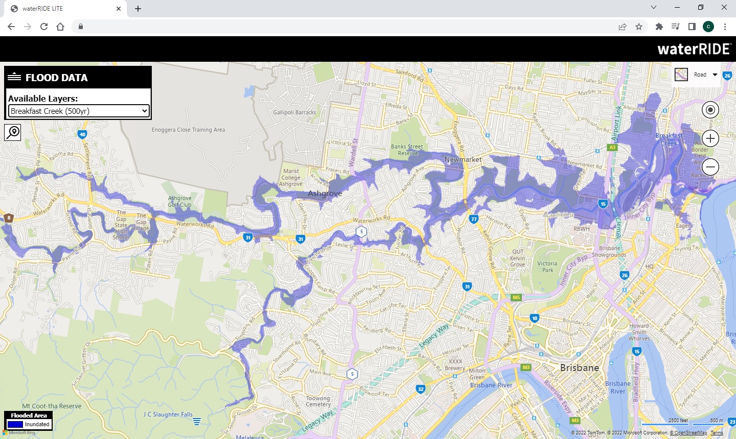
We are excited to be approaching the end of our beta testing phase of our new online module, waterRIDE LITE.
waterRIDE LITE is designed to offer a simple means of getting clear flood information to the community on any device. Essentially, its aim is to put usable flooding data in peoples pockets.
You may be looking to share design flood information as part of a revised flood study or community flood information portal.
Or, you may be wishing to ensure that the community has access to your official flood forecasts allowing them the comprehend the expected flood extent ahead of actual inundation.
As the communities appetite for clear, quality controlled and readily available information continues to grow, waterRIDE LITE allows you to publish datasets from any waterRIDE project, including any thematic settings.
If you'd like to learn more, or be part of our final beta testing, please get in contact with us at waterRIDE@worley.com
La Nina conditions are well and truly with us... again.
As we are all aware, La Nina conditions are conducive to above average rainfall for Australia, particularly for the Northern and Eastern parts.
Many users took advantage of waterRIDE's flood forecasting capability during the significant flooding earlier this year, and it was particularly pleasing to receive tremendously positive feedback on the performance of the systems.
Designed to leverage an organisations existing flood study datasets, a waterRIDE system runs in seconds and provides key flood intelligence on the likely outcomes of impending flooding ahead of actual inundation.
An effective flood forecasting system can be established using just the outputs of a flood study, meaning that most organisations have evertything they need to setup a system, and to do so relatively quickly.
This means that you can be ready for the upcoming wet, wet season.
If you'd like to discuss your specific circumstances, or are perhaps interested in some training to setup your own system, please contact us on waterRIDE@worley.com
Over the years many users have taken advantage of waterRIDE's "house photo" capability to clearly illustrate a flood level(s) on a picture of an individual property.
This capability has proven an excellent means of communicating property-specific flood risk to a non technical audience.
Instead of actual images, some users have opted to use "cartoon" graphics of a house to lessen the confronting nature of some images.
To date, each photo required a brief regisrration to scale it vertically.
However, we are currently beta testing a novel, fully automated approach utilising Google's StreetView imagery.
To use the service you will need to subscribe to Google's API framework but the images wull be scaled automatically.
You can add any number of flood levels (lines) to the image to help convey the implications of extreme flood events at a property level.
Continued strong interest in automated flood certificates sees more than 50 organisations running a waterRIDE-based system.
The release of our flood certificates API and fully hosted community facing portal enables the community to request their own flood certificates, live.
We have also been busy expanding capability and now cover common usage scenarios such as:
- Merging multiple land parcels to prepare a single certificate
- User defined polygons (eg building footprints)
- Uploading of proposed development as GIS layers
- Providing information at multiple locations across a parcel
- Customer self-help via our online, live certificates API gateway
- Incorporation of additional fooding data including flow
- StreetMaps background imagery in any graphics
If you have your flooding data available, a waterRIDE based automated certificates system is well within reach.
We are also finalising our "Certificates as a Service" offering including full data setup, management, and payment gateway. Please contact us on waterRIDE@worley.com if you would like to know more.
Our final training group sessions for the calendar year are on in a few weeks time.
Following their introduction in the March training sessions, each module now only runs for half a day.
This provides the opportunity for "bite size" sessions that do not interrupt your full working day yet provide targetted training on capability that addresses your needs.
Full details of the upcoming sessions including content and pricing are available here.