Registering an Image Within waterRIDE
To register an image either double-click on the image file name in the ‘View Contents’ or select the file and click on the 'Display Styles' button. This will bring up the ‘Image Registration Properties’ dialog.
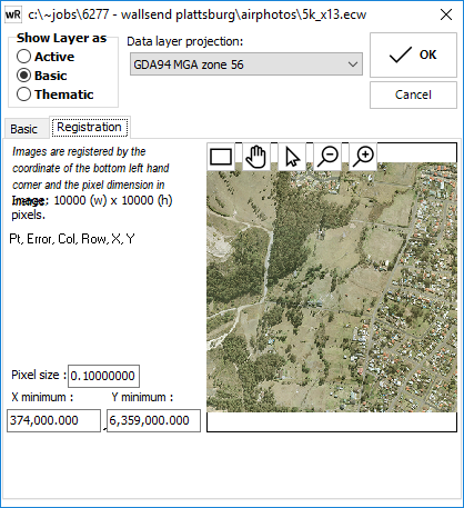
Image Registration Properties Dialog
![]() Zoom-IN: Increase the magnification and also centres the view on clicked location.
Zoom-IN: Increase the magnification and also centres the view on clicked location.
![]() Zoom-OUT: Reduce the magnification and also centres the view on clicked location.
Zoom-OUT: Reduce the magnification and also centres the view on clicked location.
![]() Zoom window: Left-click and drag – zoom to window extents.
Zoom window: Left-click and drag – zoom to window extents.
![]() Pan view: Left-click to grab and drag view.
Pan view: Left-click to grab and drag view.
![]() Image Registration: Register coordinates of the image to coordinates of the project.
Image Registration: Register coordinates of the image to coordinates of the project.
Click OK to save the modifications and exit the style dialog box, or Cancel to skip and exit.
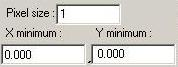
Registration properties of image, if known can be entered manually here, or Image Registration Tool can calculate the parameters.
The Image Registration Tool can be utilised if:
•you have a GIS layer that corresponds to the image.
•you do not know the exact georeference parameters (X, Y of bottom-left corner and pixel size).
How to Register an Image within waterRIDE™ Using the Image Registration Tool
To register the image, at least 3 pairs of image location / reference locations are needed. These pairs consist of a location on the image and the corresponding location on the reference GIS layer. The following figure shows three points on the image to be registered and the corresponding locations on the reference GIS layer.
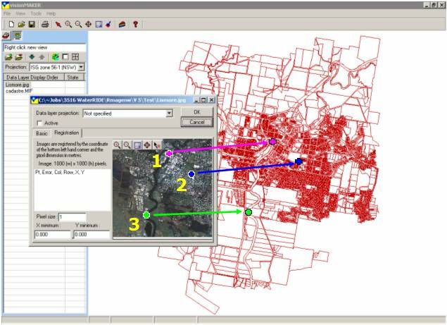
Image Registration Image / Reference Pairs
The 'Image Registration' button ![]() is used for specifying the image / reference location pairs. Clicking this button will enable the user to click a known location on the image, followed by its corresponding location in the GIS reference data in the main window. This process can then be repeated for at least three location pairs.
is used for specifying the image / reference location pairs. Clicking this button will enable the user to click a known location on the image, followed by its corresponding location in the GIS reference data in the main window. This process can then be repeated for at least three location pairs.
As the pairs are entered, the percentage registration error is calculated and displayed in the registration dialog. Once at least three pairs have been entered, clicking OK will save the *.gbm file for the image.
The registration properties of a registered image can be edited using the aforementioned procedure.
NOTES:
- The image layer’s projection and the view projection must be the same for the image and any coincident vector layers to display properly.
- waterRIDE™ does not rotate the image or data layers when displaying them. When preparing an image for waterRIDE™ , it is therefore important to make sure the image is orthogonal to the projection map grid. When scanning, for example, the north/south alignment of the image should be made to match the AMG grid if that is the proposed projection.
- This should not be confused with linking an image file to an active GIS layer.