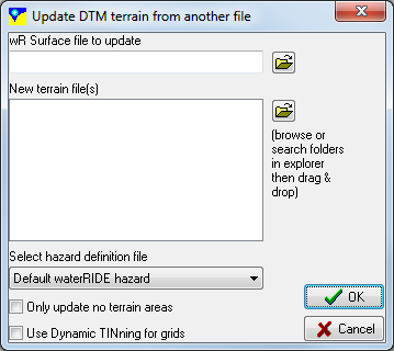
- Update Terrain Values - enables the elevation data in any existing waterRIDE™ surface to updated with the elevations in another waterRIDE™ surface file. There are a number of options for controlling what elevations how elevations will be updated.
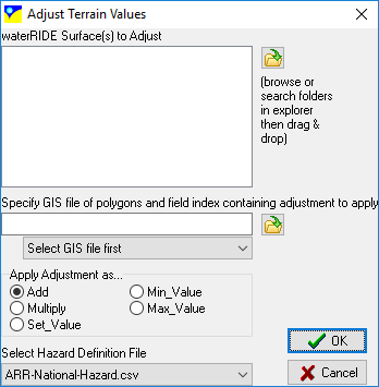
- Adjust Terrain Values - enables the elevation data in any existing waterRIDE™ surface to adjusted using polygons/points in a GIS layer. The terrain values for all cells/nodes within each polygon (or at each point) will be adjusted according to the value in the relevant field for each object, and the selected adjustment mode:
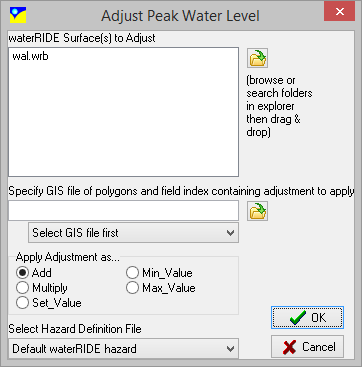
- Add: field value is added to existing terrain value (if not DELVAL)
- Mutliply: existing terrain value (if not DELVAL) is multiplied by field value
- Set_Value: terrain value is set to field value
- Min_Value: if existing terrain value is lower than field value, it is set to the field value
- Max_Value: if existing terrain value is higher than field value, it is set to the field value
- Assign Terrain As Level - will edit the water surface file so that 'terrain' data is treated as 'water level' data. This may be useful if the user has used waterRIDE™ tools to create a water surface using the same process as creating a digital elevation model (e.g. triangulating XYZ points), and wishes to specify that the levels in the file are 'water level', and not 'terrain'.
- Assign Flood Planning Level to Water Level - will edit the water surface file so that 'Flood Planning Level' data is treated as 'water level' data.
- Adjust Peak Water Levels - uses a GIS layer of polygons with adjustments specified in a numeric field to update the water surface for the selected file. The way the adjustments are applied is controlled using Apply Adjustment As... radio group.