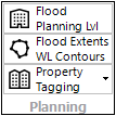
The Planning toolsets contain tools for carry out specific floodplain planning tasks:
•Creating a Flood Planning Level surface (which is far more powerful than a flood planning area/extent)
•Extracting flood extents and water level conouts as GIS layers
•Tagging properties as flood affacted