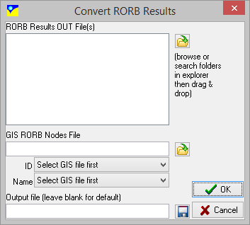
Hydrology model outputs can be converted into waterRIDE™ gauge layers (*.gag) for interrogation/visualisation. All hydrology conversions require the following information:
•Hydrology model results (*.OUT for RORB, *.TOT for RAFTS, *.CSV for URBS, and *_Meta.out for WBNM)
•GIS file of output locations/subcatchments. Generally, this is a file of points representing model output locations, however, it can be a file of polygons (subcatchments). If polygons are used, a gauge layer will be created using the centroid of each subcatchment. The GIS file must contain at least the following fields:
- ID: text field cross referencing GIS file points to model node labels. These must match exactly to the labels in the model results.
- NAME: text field used to display the name of the output location in the output gag layer. This can be set to the same as the "ID" field.