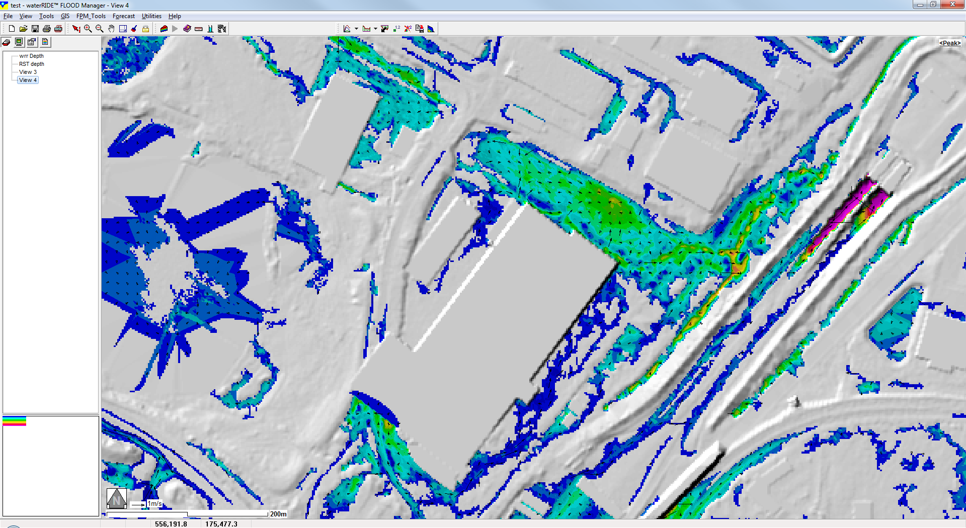
Environment Agency uFMfSW results are static (peak only) outputs provided by the Environment Agency (UK) for surface water modelling. These outputs are generally provided as ASCII grids, with a specific file nomenclature, for depth, velocity, flow direction and terrain (eg ufmfsw_tq57ne_depth_1in1000_cr.asc)
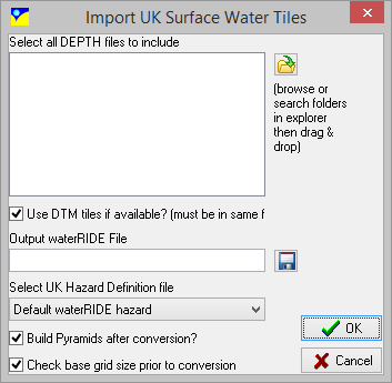
1.Select the the depth files for the tiles you wish to convert. All tiles will be merged into a single waterRIDE™ grid surface file (*.wrr), so usable file sizes should be a consideration.
2.If the DTM tiles on which the results were modelled are available, then select the option and water level can be "back calculated" from terrain and depth. Note that these must follow the Environment Agency naming convention (eg dtm2m_tm_edited_tq57ne.asc). If the DTM file cannot be located, all terrain values will be set to 0.0, and water levels will be incorrect.
3.Select the waterRIDE™ grid surface file (*.wrr) to save the merged outputs to.
4.Select the UK Hazard definition file
5.Specify whether pyramids should be built for the surface after conversion. Pyramids will significantly improve display speed, especially when data is accessed across a standard network.
6.To see how large the base grid (ie grid framework = num rows * num cols * 4 bytes) will be, select this option. Large files will usually be opened using infinite grid mode.
7.Click OK.