Allows the user to extract the outline of a number of waterRIDE surfaces (wrr, wrb, wrc). This may be useful if you are looking to create a spatially based master project to allow users to click on a catchment and load the waterRIDE project directly.
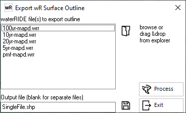
Simply add the layer(s) you wish to extract to the list.
If a single output file is selected, the extents of all layers will be added to that file.
Otherwise, leave the output file blank to create a separate GIS layer for each surface.