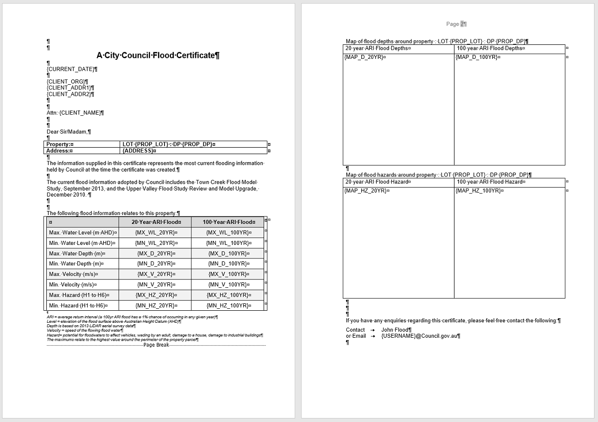
waterRIDE™ can be used to generate automated flood certificates (flood reports, section 10.1, LIMS/PIMS etc).
The system populates a Microsoft Word Template with data from:
- User Entry Fields,
- Water Surface Layers
- Water Surface Meta Data Fields
- GIS Layers
- Auto Fill Fields
- Graphics from any View
- Field values in an SQL database
- Linked photos (scaled property photos or general links)
- IF/THEN/ELSE queries
- Calculations based on other field values
Keywords (surrounded by curly braces {}) in the Word document control where waterRIDE™ inserts the relevant data, with all formatting and layout controlled by the Word document. The following image shows an example Word document with keywords contained in curly braces {}.
For further information, please refer to Flood Certificate Setup and Using Flood Certificates.
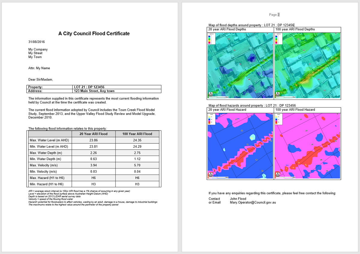
Sample Certificates Output