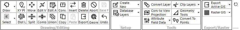
The GIS Live Panel contains toolsets for working with GIS layers. This includes tools for:
•Drawing and editing GIS layers
•Creating or connecting to new layers
•Processing and editing existing layers
•Working with/creating raster GIS layers
|
<< Click to Display Table of Contents >> Navigation: waterRIDE FLOOD > GIS |
The GIS Live Panel contains toolsets for working with GIS layers. This includes tools for:
•Drawing and editing GIS layers
•Creating or connecting to new layers
•Processing and editing existing layers
•Working with/creating raster GIS layers