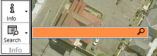
Searching is accessed from the ![]() button. Clicking the button will use the current configuration to determine how searching is carried out. In priority order, this is:
button. Clicking the button will use the current configuration to determine how searching is carried out. In priority order, this is:
1.Searchbox
2.Quick Search
3.Advanced Search
4.Online Address Server
SearchBox
The searchbox is designed as a rapid means of (primarily) searching for a property using an address using a like query.
If configured for the current project, the user:
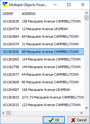
1.Enter an address and press enter (or click search) to start searching
2.If a single property matching the address is found, the view will recentre on the property and zoom to the extents of that property if possible
3.If multiple properties are found, the user is prompted to select one from the list:
Tips On Using The Searchbox
•If an online address server is used, you may need to include the town/suburb name (eg 22 Smith St, Smithville) to avoid hundreds (thousands) of records being returned
•It is a like query, so 2 Macquarie St may retrun numbers 2, 22, 32, etc
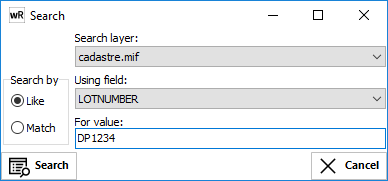
Quick Search (F3)
The quick search tool allows a user to search for a record containing a specific text string using any GIS layer in the project. If a GIS layer is active, the object found in the search will be highlighted.
The user can enter all or part of string to search for in a particular field. If multiple records are found, the user can select which record to go to. The screen will then centre (and/or zoom to) the GIS entity containing the search string in the relevant field.
Notes:
1) The string can be a partial string (e.g. 'wat' for 'water').
2) The search dialog can be opened for any active GIS layer by pressing F3 key.
3) Selecting "Zoom to Object" will zoom in to the located object.
Advanced Search (ALT-CTRL-S)
The advanced search tool allows a user to search for a record using multi-criteria boolean logic. For example, the search for properties where the "100yr_max_level" is greater than 10.21.
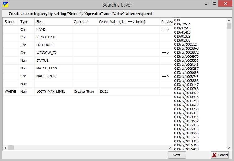
Build a Boolean query using the "Select" column. The first column must be a "WHERE", with following rows using "AND" or "OR" to build a series a Boolean logic. Clicking on the ==> symbol will preview all unique values in that GIS field.
The results of an advanced query can be saved to a CSV file by clicking the SAVE button on the search results form.
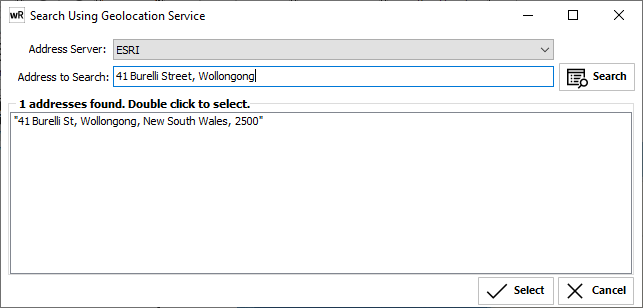
Online Address Search
This tool allows the user to search for an address using an online address server (ESRI geolocation server or BING Address Search).
Simply select the server to search with, enter a single line address, and click Search.
A ranked list of candidates is presented. Double click on the address to locate and the screen will automatically centre about the returned coordinates.
Note that most address servers use Lat/Long (WGS84) coordinates. This means that you will need to ensure that the projection for each view has been specified.
See GIS->Configure Online Address Server to setup a new server.