When using peak GIS grids exported from TUFLOW, often only the scalar total velocity grid is provided. This means that the velocity vectors will be unavailable.
If raw model results are available, you can use the guide below to extract a velocity direction grid.
1.To start, you'll need to download res_to_res.exe and TUFLOW_to_GIS.exe from the utilities section of the TUFLOW website
2.Extract velocity vector angle from the time-series result (either *.xmdf or *_V.dat) using the TUFLOW utility res_to_res as follows:
For a xmdf time series
res_to_res.exe -va -typeV results.xmdf
For a dat time series
res_to_res.exe -va -typeV results_V.dat
3.The previous step outputs a velocity angle results file, with a file name ending with _V_va,
For a xmdf time series
Results_V_va.xmdf
For a dat time series
Results_V_va.dat
4.Then extract the peak vector angle and output as an ascii grid from the time-series results using TUFLOW utility tuflow_to_gis as follows:
For a xmdf time series
tuflow_to_gis -b -asc -max -typeAll -2dm result.2dm Results_V_va.xmdf
For a dat time series
tuflow_to_gis -b -asc -max -2dm result.2dm Results_V_va.dat
*if the time-series result does not have a maximum stored, replace the ‘-max’ with ‘-tAll’, which will output results at every time step, then pick the maximum value based on time-series plots/ PO line outputs.
5.The previous process would return ascii grids as follows:
Results_V_vaMax_gXXX.asc
where gXXX is half of the grid size used in the model.
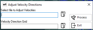
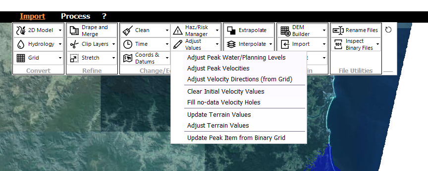
6.Adding the vector angle onto existing waterRIDE surface as follows:
Import --> Adjust Values --> Adjust Velocity Directions (from Grid)
7.Choose the waterRIDE surface and the velocity direction grid as follows: