Time-based spatial rainfall forecasts are issued by various agencies. waterRIDE™ supports forecast rainfall products from:
•Australian Bureau of Meteorology
Once converted, the forecast rainfall surfaces can be visualised/interrogated in the same way as any waterRIDE™ surface.
Note that these grids are provided in UTC time format. The time settings of the machine doing the grid import will be used to provide a localised date/time basis to the data.
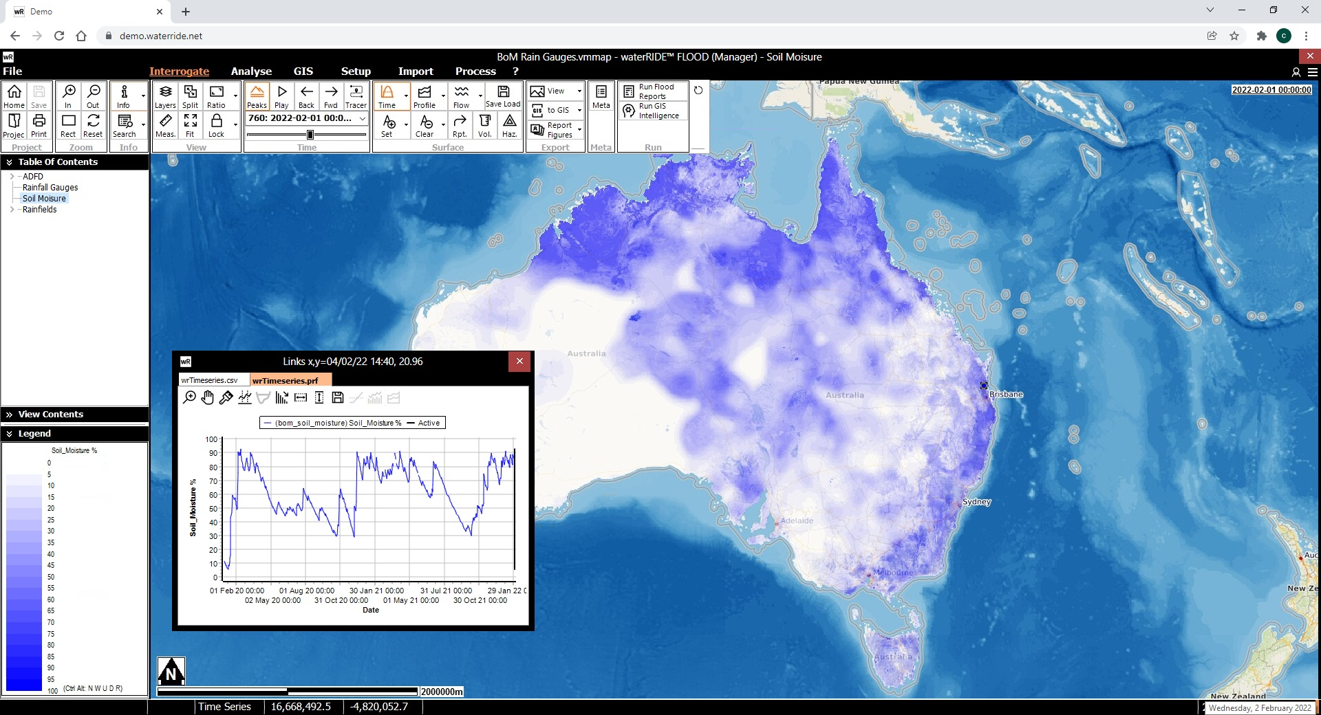
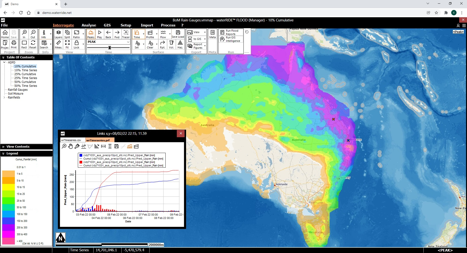
An example forecast surface is provided below:
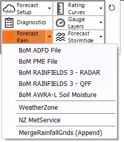
The import tools are available on the setup live panel, in the forecast group. Automatic download and conversion is available through the waterRIDE FORECAST Console.
Australian Bureau of Meterology (BoM)
waterRIDE™ supports the folllowing Australian Bureau of Meteorology forecast rainfall products (available on subscription from the Bureau - refer "registered users" catalogue):
1) Australian Digital Forecast Database (ADFD) v3: A 3-hourly expected rainfall total for the next 7 days, for probabilities of exceedance of 10%, 20% and 50%. Each dataset has a separate netCDF file (*.nc or zipped *.gz), at a 6km grid.
2) Poor Mans Ensemble (PME) v3: A 3 hourly expected rainfall total for the next 7 days, for probabilities of exceedance of 10%, 25%, and 50%. All datasets are contained within the one netCDF file (*.nc4), at a 40km grid.
3) RAINFIELDS 3 QPE (RADAR): BoM Radar-based products: calibrated, uncalibrated, blended radar + rain gauges. These products are a single netCDF file for each timstep. waterRIDE will merge multiple files into a single dataset. 1km grid (single radar) or 2km grid (multiple radar). A description of the various RAINFIELDS products are available from the BoM site. When appending these datasets, a "rolling window" can be specified to keep, say, only the last 7 days of data. This only applies to current data and is generally used when running from the FORECAST Console.
4) RAINFIELDS3 QPF: BoM QPF "ACCESS-C" ensemble. 10 minute timesteps for the next 12 hours for mosaiced radars (1,000m cell size, updated every 10 minutes), or 5 minute timesteps for the next 2 hours for single radar domains (500m cell size, updated every 5 minutes). Data is provided from BoM as a single file containing multiple ensembles and timesteps. A description of the various RAINFIELDS products are available from the BoM site.
Note that some of the above datasets are in netCDF v3 format and others netCDF v4. To avoid issues, you should ensure that you have the netCDF_v4 folder in your waterRIDE Common folder (normally c:\program files (x86)\waterRIDE\Common). If not, you can download it from https://www.waterRIDE.net/Downloads/netCDF_v4.zip
To import any of the above datasets, download the netCDF file(s) from the Bureau's FTP site and use the relevant import routine. A waterRIDE™ grid (*.wrr) file will be created.
Where datasets contain ensembles, you can either specify the ensemble ID to convert, or use an ID of -1 (default) to have waterRIDE determine:
a. the upper bound across all ensemble values for each cell,
b. the upper bound across all ensemble values for each cell, and
c. the average value of all ensembles for each cell.
[LEGACY SUPPORT] To provide a seamless dataset of 7 days rainfall forecasts, the ADFD and PME datasets can be merged. In this case, the finer scale ADFD dataset will take priority over the coarser PME dataset (ie the first 2 days will be based on the ADFD dataset, and the remaining 5 days on the PME dataset). As the ADFD now provides 7 days of data, this feature is redundant.
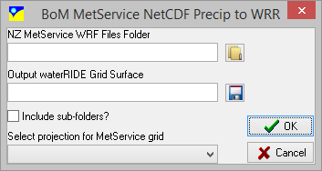
MetService (NZ) publishes time-based forecast rainfall surfaces in netCDF format. Select the file to convert and specify the desired output projection.
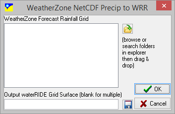
WeatherZone publishes time-based fallen and forecast rainfall grids in netCDF format. Select the file(s) to convert.
waterRIDE Forecast Rainfall Data Pack
Ready to use, continuously updated forecast datasets are available as an easy to use subscription. Just add the datasets to your forecast (or any) project for interrogatable access to a range of short and long term rainfall forecasts, radar rainfall products, fallen rain gauge datasets and soil moisture. Please refer to the website for current package inclusions.